

Geography Sahara
Geography
A geographical map of Africa, showing the ecological break that defines the Saharan area
The main biomes in Africa
The Sahara covers large parts of Algeria, Chad, Egypt, Libya, Mali, Mauritania, Morocco, Niger, Western Sahara, Sudan and Tunisia. It covers 9 million square kilometres (3,500,000 sq mi), amounting to 31% of Africa. If all areas with a mean annual precipitation of
less than 250 mm were included, the Sahara would be 11 million square kilometres (4,200,000 sq mi). It is one of three distinct physiographic provinces of the African massive physiographic division.
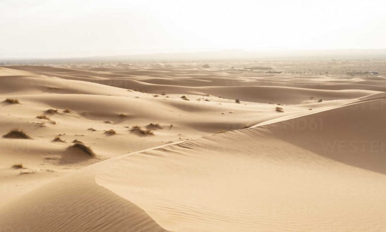
The Sahara is mainly rocky hamada (stone plateaus); ergs (sand seas – large areas covered with sand dunes) form only a minor part, but many of the sand dunes are over 180 metres (590 ft) high.[9] Wind or rare rainfall shape the desert features: sand dunes, dune fie
lds, sand seas, stone plateaus, gravel plains (reg), dry valleys (wadi), dry lakes (oued), and salt flats (shatt or chott).[10] Unusual landforms include the Richat Structure in Mauritania.